
Another great walk from Crowden, this location has plenty of scenic walks and here’s another to add to your ever-growing list!
This 12-mile route begins by jumping on the Pennine Way path for a short distance before heading off west towards the boundary of the Peak District National Park. The walk takes you along the edge, with views of the reservoirs below, then loops round over Arnfield Moor with an all important waterfall stop!
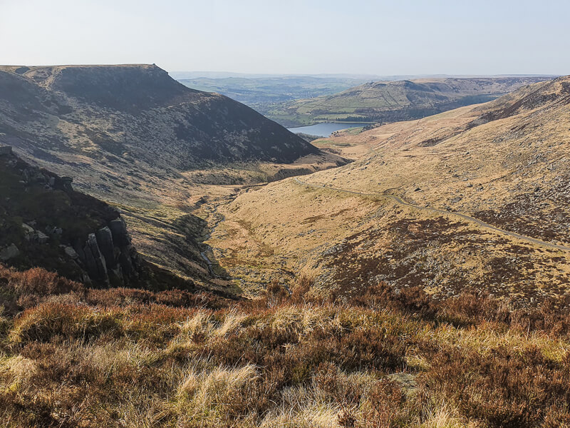
From here, you begin to head north across moorlands towards Chew Reservoir. As you reach the edge, you’ll see views of Dovestone Reservoir in the distance. Take the path heading east, past Chew Reservoir. There’s an optional off-path detour to Featherbed Moss Trig Point here, if you’re trig bagging! And finally you’ll hit Laddow Rocks and pick up the Pennine Way path heading back down to Crowden.
This route is tricky in places with a couple of short off-path sections and some places where the path is hard to follow due to boggy terrain. Don’t let that put you off, it’s nothing that good waterproof footwear and a map/compass won’t fix. But please be aware in bad weather it can be easy to get disorientated on the off-path sections. Read the detailed route descriptions for more information on these sections.
Here you will find details on how to get to the start of the walk at Crowden, route information, map, GPX file, plus a detailed step by step guide of the walk.
Let me know in the comments if you’ve done this walk and what you think!
Arnfield Moor + Chew Reservoir from Crowden
Walk information
Walk type: Medium/long circular walk
Distance: 19.1 miles/11.9 km
Walk time: 5-6 hours
Total ascent: 862 m/2,828 ft
Highest point: 541 m/1,775 ft
Walk highlights: Views of the valley from Crowden, Millstone Rocks, Arnfield Brook waterfall, views of Dovestone Reservoir, Featherbed Moss trig, Ladder Rock and Pennine Way
Trig points: 1 – Featherbed Moss
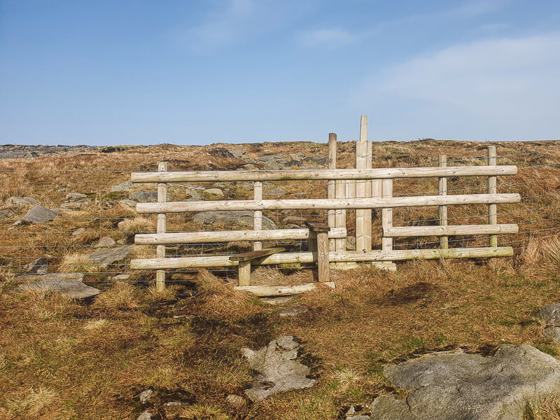
Stiles: 10 (only 4 dog-friendly)
Arnfield Moor + Chew Reservoir walk map

© Crown copyright and database rights (2024) OS 002572460
Walk start point
Start grid reference: SK 07200 99231
Car parking address: Crowden car park, Woodhead Road, (A628) Glossop, SK13 1HZ* – Google maps
*Please note this postcode covers a wide area so may not take you to exact spot. But the parking is signposted off the A628 road.
This is a free car park it is pretty small and it can be popular at weekend, there’s some parking on the side road outside if the car park is full.

Public transport
There is no train station near to the start of this walk. However, there is a First Group bus service that goes along the road, so could drop you off at the start. The services are fairly minimal at the moment, so you’d need to research beforehand.
Facilities on the walk
There is a small public toilet block available at the start of the walk at Crowden (open 8 am to 8 pm).
At Crowden campsite they have a small shop and toilets, which basic snacks and drinks. There is nothing else on the route.
During the first section of the walk, there are plenty of opportunities to collect water from the streams to drink. I use a filter water bottle.
I’ve stayed at the campsite and it’s a lovely place to stay if you want to do a longer hike or explore more of the area.
Other useful information
The section Chew Reservoir to Featherbed Moss trig point and back to Laddow Rocks is largely off-path. It is moorland area and the terrain looks very similar. I highly recommend using a compass bearing across the section.
In bad weather, there is a high chance you can go the wrong way and the trig is only visible with about 100 metres to go.

There are sections of this walk that can be slightly flooded and boggy, depending on the weather conditions. I’d recommend waterproof footwear, also gaiters would be good for some sections.
Due to the remoteness I would also recommend you take extra warm layers and waterproofs to be ready for all weathers once up high.
The route has almost no signposts, I recommend you take a map and compass (see below).
Please keep the Peak District beautiful and respect everyone who uses the park. Take ALL your rubbish home to dispose of and remember close gates (as you found them). Thank you so much.
Would you know what to do in an emergency situation?

We have a guide with what to do, who you need to call and also some useful kit that should be in your backpack. Ask us any questions in the comments or via our social media.
Happy hiking + stay safe
read herePeak District weather
Check the weather for your walk location and hills. The moorlands are very remote and there is no protection from incoming weather.
The weather can vary widely from your start location to the top of the hills so please check the conditions and make sure you have warm clothes/waterproofs if necessary.
- BBC Weather for Crowden
- Met Office weather for the Peak District
- Met Office weather for Black Hill and/or MWIS (Mountain Weather Information Service) for the Peak District.
Ordnance Survey walk map
The map for this walk is the Ordnance Survey OL1 – Peak District (Dark Peak Area). Check prices here with Ordnance Survey or Amazon. If you’re hiking in all weathers the Active OS maps are good to have.
And don’t forget your compass, I recommend the Silva Expedition or the Silva Classic compass..
For online maps, I recommend the OS Online App (I have been using it for many years and it is worth getting if you want to start walking more). Check prices here for the one-month or annual option with the OS Online App. All the walks on the website are created using OS Online + you can download them to the App.
Arnfield Moor + Chew Reservoir walk route
Stage 1 – Crowden to Arnfield Brook waterfall
Distance: 3.7 miles/5.9 km
Grid reference SK 07250 99285
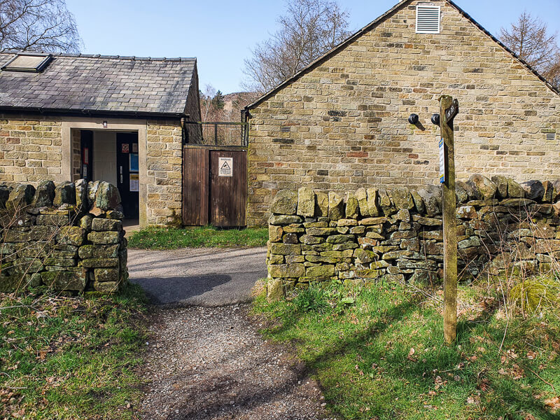
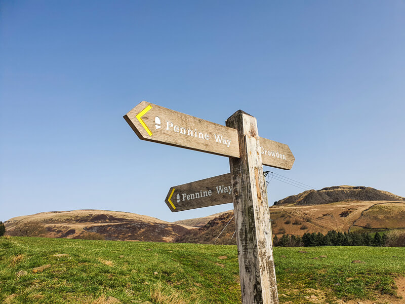
From the car park take the footpath at the far end, leading towards the campsite. Go through the hole in the wall and turn right (this is also where the toilets are). Walk up the path then turn left past the campsite. Go though two gates and continue walking as the path begins to go up. Shortly after the second gate look for the Pennine Way fingerpost sign, turn right here.
Walk up the track through three wide gates (you may need to climb the stiles if they are locked). Then you’ll reach a small gate, go through and turn left on a narrow track as it leads uphill. Follow this towards a stone wall, here the path bends round to the right and follows the wall uphill.
Go over a wooden stile (dog-friendly) and continue on the path heading uphill on the narrow track. Eventually it flattens out, but this is where it starts to get boggy! Navigate around the boggy bits as best as you can!
There’s a large cairn shortly before you reach Lad’s Leap (where Hollins Clough runs down). Keep following the narrow path along the edge. After 400 m the path splits, keep on the lower path and continue over a stile and down to the fence line (very boggy parts!).
At the fence, don’t go over the stile but stay on the path as it follow the fence all the way along (yes, more bog along here!). Follow the path along here, over another stile and begin to descend, you’ll notice numerous small pillars in front of you!
Walk along the footpath, on your right in the distance you’ll see a green Shooting Cabin and a brook below it. Shortly after you’ll see a narrow track doubling back on yourself.
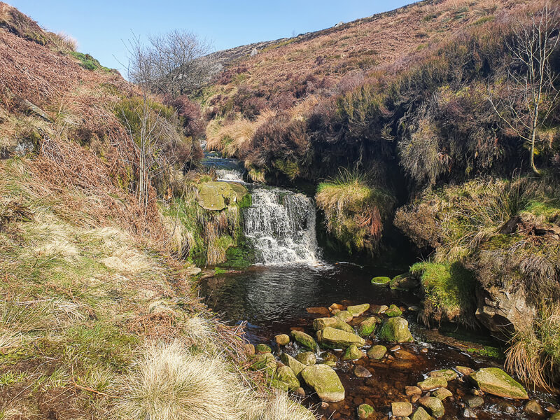
Walk down the track, heading downhill towards the brook. The closer you walk to the brook the boggier it becomes! As you continue you’ll spot the waterfall ahead.
Stage 2 – Arnfield Brook waterfall to Pennine Bridleway
Distance: 2.1 mile/3.4 km
Grid reference SK 02676 98701
Once you’ve stopped to admire the waterfall, maybe even dipped your toes in the water. Scramble up the bank of the brook on the left and head upwards through the heather. There are signs of a faint sheep trod here. Keep walking up and eventually the Shooting Cabin will come into sight after about 500 m.
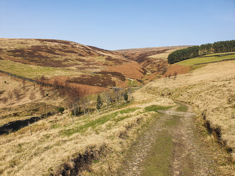
From the Shooting Cabin take the wide track heading southwest for 1 km. Go over the stile next to the gate and continue down the track until it meets the Pennine Way Bridleway (PWB). Turn right and follow the track next to the wall, then the path goes round a tight bend before descending to a stream (Ogden Clough).
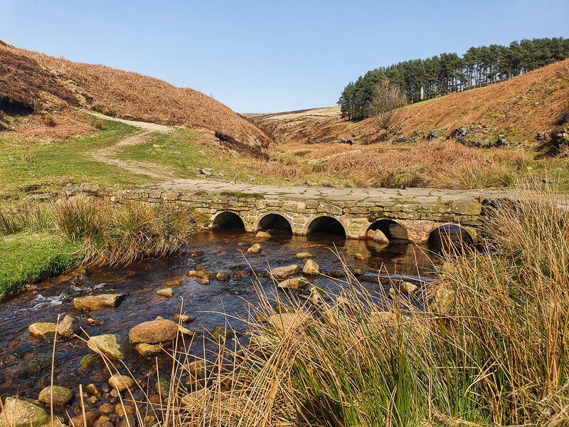
Walk through the gate, then cross the second stone bridge and follow the Pennine Way Bridleway uphill. Go though the next gate, then shortly after you’ll see a wooden signpost, this is where you leave the Pennine Way Bridleway.
Be careful not to follow the double track slightly before as this leads off in a different direction.
Stage 3 – Pennine Bridleway to Featherbed Moss Trig
Distance: 3.3 miles/5.3 km
Grid reference SK 01480 99009
Walk along the narrow track which follows Ogden Clough/Brook all the way along until you cross over a small wooden bridge.
Tip – it’s best to use a compass bearing for this next section.
The path now bears to the right and begins to head uphill towards a stile over the fence. Continue following the path then over another (new) stile. The route now becomes a little hard to follow in places along this section of Ormes Moor. It’s waterlogged/boggy in places so you’ll find yourself deviating from the trod.
After about 1.5 km of moorland walking, you’ll eventually reach the edge. To your right you’ll see glimpses of Chew Reservoir and down to your left Dovestone Reservoir. At the edge, turn right and follow the narrow path along all the way to Chew Reservoir (the path splits with an upper and lower path but they both end up there).
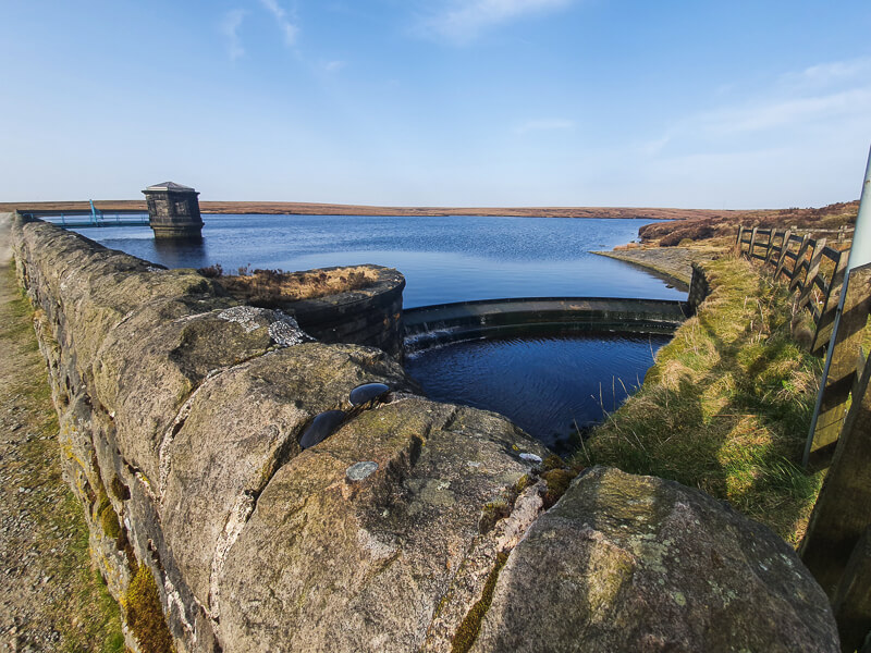
At Chew Reservoir, continue heading in the same direction, walking alongside the reservoir, (with it on your left). Keep on the track to the end of the reservoir, once you are 100 m from the end point and have crossed the final stream (Green Grain on the OS map) you can now head off-path to Featherbed Moss Trig.
Tip – it’s best to use a compass bearing for this next section.
From the reservoir, you’re turning right in a south southeast direction and heading uphill across the moorlands. There are many cloughs which can easily send you on a detour.
After around 800 m you’ll reach the Featherbed Moss Trig, in bad weather it’s very easy to get lost and due to the landscape you’ll only see the trig with about 100 m to go.

Stage 4 – Featherbed Moss Trig to Crowden
Distance: 2.5 miles/4 km
Grid reference SE 04660 01165
From Featherbed Moss Trig there’s now a path on the map, although it’s still easy to lose it. Again I recommend taking a compass bearing to follow the 800 m to the fence. Here you’ll be greeted with a waterlogged stile to cross!

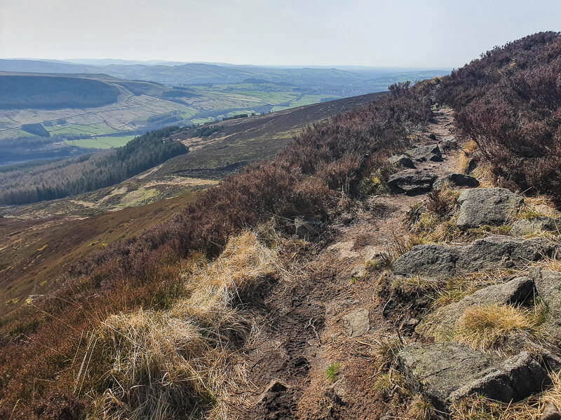
Walk on the path down to the edge. On your left you’ll see the prominent Laddow Rocks, but you turn right and follow the narrow path heading downhill. There’s a short section with small flagstones but then they disappear and a narrow track continues.
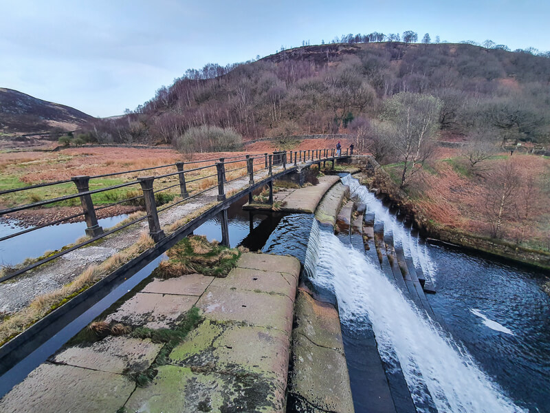
The path winds down, past several gritstone rocks, across two streams. After the second, keep following the path downhill, but look for a footpath forking off to the left. Take this path downhill, over a stile then across the bridge over the weir. Once across, follow the path round to the right, the next gate is often locked so you may need to climb over the stone wall (it’s not too high).
Then turn right and walk down the towards the campsite, turn down the path past the toilets and then left through the trees and back into the car park.
Ask me questions about the walk in the comments below.
Further information + walk ideas
More walks in the Peak District
Love the trig walks in the Peak District? You might like these circular walks.
- Alderman’s Hill Walk (+ Saddleworth Trig) From Greenfield | 3 or 5 Mile Route
- Stanton Moor Plantations + Oaker Hill Trig Walk from Birchover | 10-Mile Route
- Langsett Reservoir, Margery Hill + Outer Edge Trig From Langsett Barn | 13-Mile Route
Or check out all our Peak District walking routes here
Peak District Walks is a FREE online resource. Are you enjoying the walks? You can say thank you and buy me a coffee here. Thank you very much 🙂
Peak District charity patches
Read about the charity here.


Charity Patches

Charity Patches

Charity Patches

Charity Patches

Charity Patches

Charity Patches
Need more help planning your Peak District trip?
Join our Peak District walks Facebook page, follow us on Instagram and Twitter for inspiration.
More information on the Peak District, including transport options, where to stay, best Peak District pubs + other useful resources.
Check out the 7 YHAs in the Peak District and find the best walks direct from your accommodation.
Find out what maps you will need for your trip here.
Top tips - Read our useful guides on hiking tips here.
Guided Walks with an introduction to map reading (see dates here).
Visit our hiking recommendations page, (footwear, clothes + kit).
Or get in touch and I will help as best I can :).
Please note 'Peak District Walks' accepts no liability for any injuries or accidents resulting from walking our routes. We always recommend you wear appropriate footwear to avoid injuries and to take a paper map and compass on your walks. Read more here.
*Peak District Walks participates in the Amazon Services Associates Programme, as well as other affiliate programmes. If you purchase through these, Peak District Walks earn from the qualifying links. This is at no extra cost to you. Read more here.