If you love the outdoors and hiking in the Peak District then this post is for you. Here are the top 12 best hikes in the Peak District in the dark peak area.
There is a range of different length hikes, from 5 to 24 miles. If you’re short on time you can still fit in a great hike. Or, if you have the full day, you can choose one of the longer walks and explore more of the Peak District.
The hikes include a range of different locations in the dark peaks from popular locations like Castleton and Edale, hiking up Kinder Scout and Mam Tor to quieter less-popular spots so you can get away from the crowds (if that’s what you prefer).
Do you love hiking in the Peak District? Let me know if you’ve done any of these walks in the comments.
Hiking in the Peak District
Here are a few top tips and essential gear items that you might need for your Peak District hike. If you’re new to hiking then feel free to ask any questions in the comments or sign up to receive weekly walks (see above) and join our Facebook group for more tips.
Essential gear

Depending on the weather there are a few useful items that will be handy for your walk. As well as the normal hiking gear, backpack and waterproofs, good footwear is essential. Whilst the Peak District doesn’t have rocky terrain like the Lake District or Snowdonia National Park there are still challenging sections on the walks.
The Peak District Dark Peak area is known for its peaty moors and this basically means it can be boggy in areas. If you’re doing a longer hike then it’s good to keep your feet dry, Gore-tex hiking shoes and boots are great, but for some walks, gaiters are really useful too, especially on a rainy day hike.
Day hiking list
- Backpack 20-30 litres
- Waterproof jacket and/or trousers
- Gaiters (optional)
- Warm layer
- Snacks + water
- Map + compass
- First aid kit
Check out our recommendations here for hiking gear, clothes and footwear or get in touch with any questions.
Top tips

Navigation
On clear days the Dark Peak area can be wonderful, navigation becomes much easier when you can see where you’re going. Hikes such as Kinder Scout or Higher Shelf Stone are popular routes but if the cloud comes in it can all look very similar up there and it’s easy to get lost.
We’d always recommend you take a paper map + compass (this one is good), as well as any navigation tools you use on your phone, (we use OS Online mapping tools). Although you can use the online mapping in flight mode to save battery it’s not a guarantee, phones can get wet, cables can break, which can ultimately mean you could get lost.
The Edale Mountain Rescue team (charity ran by volunteers) is one of the busier teams in the country so don’t call them out unnecessarily if you can prevent it :). We will be launching some charity badges soon – register here to receive the early bird discount code.
Water

On hot summer days, hiking is amazing in the UK but of course, it means dehydration is more of a risk especially whilst hiking up all those hills and sweating like crazy!
Always take plenty of water, as hiking on the moors there are limited water sources. You can take a filter water bottle to save carrying extra, I use a Water-to-Go bottle on all my hikes so I can fill up from streams on the walk.
12 Best Peak District Hikes

Here are the top Peak District walks in the Dark Peak area, covering the northern Derbyshire, South Yorkshire and Greater Manchester parts of the Peak District.
Scroll down the walks, see which ones you’re interested in. Then for the full walk route, map and GPX file click the link and you’ll have a detailed post on the walk so you can focus on enjoying your day.
Kinder Scout via Grindsbrook from Edale

Distance: 8 miles/13 km
Walk time: 4-5 hours
Total ascent: 806 m/2,644 ft
Starting with my favourite and also the first hike I did in the Peak District. This route starts in Edale village and takes you up via Grindsbrook Clough. A flagstone path at first but turning into rocky terrain as you climb higher, with a short scramble to reach the top of the Kinder Plateau.
The walk from here takes you along the edge of Kinder Scout and up to Kinder Low trig point, you can add an extra out and back to reach the small pile of stones which marks Kinder Scout summit.
Once you’ve ticked off the highest peak in the Peak District the route descends via Jacob’s Ladder and back into Edale. Where you can finish your hike in style with a visit to one of the Edale’s pubs – The Old Nags Head or Ramblers Inn. The perfect end to the day.
Fancy giving this walk a go? Here’s the full route, map and everything you need to know!
Walk route, map + GPX here
Alport Castles from Ladybower Reservoir

Distance: 10 miles/17 km
Walk time: 4-5 hours
Total ascent: 794 m/2,604 ft
The second best Peak District hike on the list includes a walk with another scramble section. This hike starts from Ladybower Reservoir and takes you up through the woods to the edge of Alport Moor, making your way towards Alport Castles, a huge landslide which is pretty impressive to see.
The scramble is optional, you see the picture of The Tower above, to add some more adventure to the day you can scramble to the top for some amazing views of the whole area from a different perspective.
After all the ups, you then descend to the River Alport, following it for a short while before hiking back up then down to Ladybower Reservoir to finish your walk. As an extra, you can walk round to Derwent Dam which is fantastic to see, it’s even more impressive when the reservoir is full and you can see it overflowing (heavy rain required!)
The full walk route, where to pack and useful information about the walk is right here.
Walk route, map + GPX here
Laddow Rocks + Black Hill from Crowden

Distance: 9 miles/14 km
Walk time: 4-5 hours
Total ascent: 589 m/1,932 ft
The Laddow Rocks and Black Hill hike from Crowden is further north in the Peak District and it’s quieter location means that this hike isn’t as busy as some of the other ones on the list, but that doesn’t mean it’s not equally beautiful.
The walk begins from Crowden, on the Woodhead Road and initially follows the Pennine Way National Trail route all the way up to Laddow Rocks and Black Hill trig point. From here it loops across the moorland and back to Crowden.
For the full route description, map and useful information, read the route here.
Walk route, map + GPX here
Stanage Edge from Redmires Reservoir

Distance: 13 miles/20 km
Walk time: 5.5-6.5 hours
Total ascent: 529 m/1,733 ft
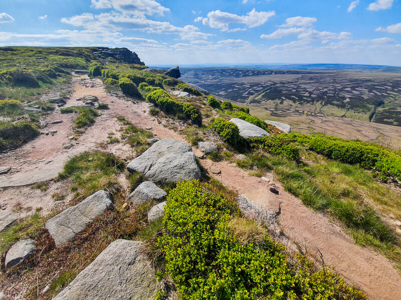
This fantastic hike includes quieter parts of the Peak District but also one of the popular places – Stanage Edge. This hike is also one of the trig bagging collection, including three trig points on the walk, plus a bonus fourth if you add a couple of miles to it.
You begin the walk at Redmires Reservoir and make your way across to Rod Moor, including trig number one. From here you make your way over to the Ox Stones and trig number two.
Then lastly, it’s up via Upper Burbage Bridge to reach Stanage Edge, the third trig, and a walk along the edge with views of the valley. There’s an option to continue walking all the way to High Neb, a trig point further down, before doubling back and returning to Redmires Reservoir.
Read the full route here
Walk route, map + GPX here
Dovestone Reservoir + Trinnacles from Greenfield

Distance: 12 miles/19 km
Walk time: 6-7 hours
Total ascent: 857 m/2,812 ft
This is the most northerly hike on the list, with beautiful views across Greenfield and Dovestone Reservoirs, waterfalls plus some scrambling up Birchen Clough and the iconic The Trinnacles, this walk has something for everyone!
The route begins with a gentle walk along the reservoir, good for a warm up but then pretty soon you’re scrambling up Birchen Clough and onto the edge, with views across Saddleworth Moors. From here the walk takes you along the edges, past Ashway Rocks and many other gritstone formations.
Eventually you reach Chew Reservoir, from here you continue along the tops until reaching Alphin Pike, where you descend back down to Dovestone Reservoir. This hike makes a great day out, highly recommended that you do on a clear day to appreciate those views!
Read the full route here.
Walk route, map + GPX hereWant to read later? Save the walk to Pinterest

Higher Shelf Stones + Crash Site from Snake Pass

Distance: 6 miles/9 km
Walk time: 3-3.5 hours
Total ascent: 488 m/1,601 ft
One of the shorter hikes on the list, but since Higher Shelf Stones summit is the third highest point in the Peak District I felt it had to be on the list! The great thing about this walk is that you begin from Snake Pass so for the first part of the hike you don’t have too much ascent.
The routes first heads to Higher Shelf Stones summit, from here you can make a short detour to visit the plane crash site from 1948, with debris scattered over a wide area. The walk then goes via Lower Shelf Stones and gradually descends to Shelf Brook, beautiful in late summer with the purple heather out everywhere.
Then it’s a hike back up to Snake Pass but with views of Higher Shelf Stones on your left as you ascend, it’s a great way to see the summit from a different angle.
For the full route, plus useful tips about navigating across the moorlands to the plane crash site read here.
Walk route, map + GPX here
Edale Skyline Challenge from Hope or Edale

Distance: 20 miles/32 km or 24 miles/38 km
Walk time: 8-10 hours or 10-12 hours
Total ascent: 1,252 m/4,107 ft or 1,607 m/5,272 ft
The Edale Skyline hike is one of the ultimate long-distance walks in the Peak District. If you love your challenges then this is the one for you! The walk takes you around the hills surrounding Edale.
Traditionally the route is a fell race that starts from Edale, but as this is a popular place in the Peak District the route can be started from Hope and you’ll still tick off all the hills, you just miss out the extra ascent/descent into Edale.
The hike is pretty tough, the distance alone is a challenge but then you have a fair amount of descent as you navigate around the route, ticking off Win Hill, Kinder plateau, Brown Knoll, Lord’s Seat, Mam Tor and Lose Hill – but if you like a challenge then go for it!
Both routes options from Edale and Hope here, including GPX file for both walks.
Walk route, map + GPX hereDerwent Edge from Ladybower Reservoir

Distance: 10 miles/16.5 km
Walk time: 4-5 hours
Total ascent: 624 m/2,047 ft
Derwent Edge hike is a great route to see beautiful views of the Peak District and in the late summer months, much of the edge is covered in beautiful purple heather making for a very different view.
The terrain for this route is slightly easier than some of the other hikes on this list as a large part of the route along the edge has a flagstone path, making it easier for navigating too. From Ladybower Reservoir you go past Derwent Dam, along Derwent Reservoir then ascend to Lost Lad and Back Tor, the start of Derwent Edge.
Walk along the edge then back down via Ladybower Resrvoir to the start for a lovely circular hike in the Peak District.
Read the route guide plus useful information here.
Walk route, map + GPX here
Kinder Scout + Kinder Downfall from Edale

Distance: 15 miles/24 km
Walk time: 7-8 hours
Total ascent: 1,183 m/3,381 ft
A brilliant longer hike from Edale, this route is great as you get to explore a wider area of Kinder plateau, as well as a fun scramble up Grindsbrook, Kinder Downfall and Jacob’s Ladder too.
From Edale in Derbyshire, the route goes up Grindsbrook Clough to reach the top of Kinder plateau, then you pick up the flagstone path across the top via Crowden Rocks before the flagstones and paths fade away. You have a fun section navigating through the Woolpacks (a group of gritstone rocks) until you reach Noe Stool.
From here you walk across to Kinder Low trig point then picking up the Pennine Way on to Kinder Downfall and down to Kinder Reservoir via Willian Clough. Then it’s back around the back to pick up the path and Jacob’s Ladder into Edale.
A challenging hike but a fantastic route, full guide and map here.
Walk route, map + GPX here
Mam Tor + Lose Hill from Castleton

Distance: 7 miles/11 km
Walk time: 3-4 hours
Total ascent: 535 m/1,755 ft
This dark peak hike has to be one of the classic Peak District walks, starting in the lovely Derbyshire village of Castleton, the route takes you up to two iconic Peak District Hills – Mam Tor and Lose Hill.
But in between the two hills, you get to walk along the Great Ridge, via Back Tor, which is a brilliant route. This walk is popular so if you can visit mid-week or on an evening you’ll have a quieter experience but the views are so beautiful you won’t be disappointed.
The full route here for you to read.
Walk route, map + GPX here
Kinder Scout via Fairbrook from Snake Pass

Distance: 8 miles/13 km
Walk time: 4-5 hours
Total ascent: 694 m/2,276 ft
Kinder Scout is one of those must-do hikes in the Peak District, the Kinder Plateau is a huge area which has many different routes up. This hike takes you up from Snake Pass exploring the northern edges of Kinder Plateau. It is quieter than the routes from Edale or Hayfield, on sunny days there are also a few great spots to stop for a dip in Fair Brook.
From Snake Pass, you ascend via Fairbrook to the top of Kinder Plateau then turn right and follow ‘the edge’, until it brings you out to the Pennine Way, join the path for a short time before turning right back down Ashop Clough to Snake Pass.
Read the full walk route here.
Walk route, map + GPX here
Winnats Pass + Mam Tor from Castleton

Distance: 5 miles/8 km
Walk time: 2.5-3 hours
Total ascent: 409 m/1,342 ft
Another short hike on the list, but with two fantastic Peak District locations – Winnats Pass and Mam Tor. Both of these can be seen from the road and you’ve probably driven past on your route into Castleton village.
This walk begins from Castleton and takes you up a very steep route to the top of Winnats Pass, but it’s totally worth it. Then once you’ve walked along the top of Winnats Pass you descend then cross to the base of Mam Tor where it’s back up again to reach the trig point at the top.
It might be a short route but don’t underestimate how tough it is, especially the hike up to Winnats Pass (and back down). The route is steep and I wouldn’t recommend doing in the rain as it will be even more slippy!
Walk route, map + GPX hereWhich one of these hikes are you planning on doing first?
Ordnance Survey Walk Maps
Get organised for your walks now and get yourself a map and compass 🙂
For these hikes in the dark peak area, the map you need is the OL1 – Peak District (Dark Peak Area).
You can buy online at Amazon or Ordnance Survey.
And don’t forget your compass, I recommend the Silva Expedition or the Silva Classic compass.

For online maps, I recommend the OS Online App (I have been using it for many years and it is worth getting if you want to start walking more). Check prices here for the one-month or annual option with the OS Online App. All the walks on the website are created using OS Online + you can download them to the App.
Check prices here for the one month or yearly option with OS Online App.
More walks in the Peak District
Want to try walks in the White Peak Area? Check out these great walks
- Chee Dale (Stepping Stones Walk)
- Wolfscote Dale + Biggin Dale
- Shutlingsloe Walk (via Macclesfield Forest)
Or check out all our Peak District walking routes here
Save me to your Hiking boards on Pinterest


*Peak District Walks participates in the Amazon Services Associates Programme, as well as other affiliate programmes. If you purchase through these, Peak District Walks earn from the qualifying links. This is at no extra cost to you. Read more here.
Peak District Walks is a FREE online resource. Are you enjoying the walks? You can say thank you and buy me a coffee here. Thank you very much 🙂
Peak District charity patches
Read about the charity here.


Charity Patches

Charity Patches

Charity Patches

Charity Patches

Charity Patches

Charity Patches
Need more help planning your Peak District trip?
Join our Peak District walks Facebook page, follow us on Instagram and Twitter for inspiration.
More information on the Peak District, including transport options, where to stay, best Peak District pubs + other useful resources.
Check out the 7 YHAs in the Peak District and find the best walks direct from your accommodation.
Find out what maps you will need for your trip here.
Top tips - Read our useful guides on hiking tips here.
Guided Walks with an introduction to map reading (see dates here).
Visit our hiking recommendations page, (footwear, clothes + kit).
Or get in touch and I will help as best I can :).
Please note 'Peak District Walks' accepts no liability for any injuries or accidents resulting from walking our routes. We always recommend you wear appropriate footwear to avoid injuries and to take a paper map and compass on your walks. Read more here.