
A beautiful 7.5 mile loop from Ilam Hall, ticking off both an Ethel and trig point at Musden Low. The route also takes you via the ruins of Throwley Old Hall and you’ll have stunning views walking down the Manifold Valley.
From Ilam Hall, you head through the grounds then over the River Manifold heading across fields before you begin your uphill climb towards Musden Low trig point then it’s back down walking towards Calton. The route then takes you over more fields until you reach the ruins of Throwley Old Hall.
There’s a road section which is part of the Manifold Trail and continues until you reach the ground of Ilam Hall, so please take care on this section. And finally, you’re back in the stunning grounds of Ilam Hall and Park where you end your walk.
Here you will find details on how to get to the start of the walk at Ilam, route information, map, GPX file, plus a detailed step by step guide of the walk.
Let me know in the comments if you’ve done this walk and what you think!
Buy a printable/downloadable PDF route guide for the walk here.
Musden Low + Throwley Old Hall from Ilam Hall

Walk information + GPX
Walk type: Medium circular walk
Distance: 7.5 miles/12.1 km
Walk time: 2.5-3.5 hours
Total ascent: 355 m/1,164 ft
Highest point: 359 m/1,177 ft
Walk highlights: Musden Low trig (and an Ethel), Ilam Park, the ruins of Throwley Old Hall, sweeping views down the Manifold Valley, views of Thorpe Cloud and Bunster Hill.
Trigs: 1 – Musden Low
Ethels: 1 – Musden Low
Stiles: 10 (wooden and stone step stiles)
Musden Low + Throwley Old Hall walk map
© Crown copyright and database rights (2024) OS 002572460
Click for online mapWalk start point
Start grid reference: SK 131 507
Car parking address: Ilam Hall car park, Ilam, Ashbourne, Derbyshire, DE6 2AZ – Google location
Ilam Hall car park is owned by the National Trust so car parking is free for National Trust members.
Parking costs* (make sure you have coins for the parking machines)
- £6.00 for up to 4 hours
- £8.00 for over 4 hours
*Correct at time of writing.
Alternatively, you can start the walk at Blore Pastures car park, which is a small free car park a short distance from the start of the walk
Public transport
There are no public transport options for this walk.
Facilities on the walk
There are public toilets available at the start of the walk at Ilam Hall.
Ilam Hall also has a café and a shop for refreshments either before or after the walk.
Other useful information
There is about 2 km of road walking on this route, after Throwley Old Hall, please take care on this section and keep to the right when walking on the road to ensure you can see approaching traffic.
Please keep the Peak District beautiful and respect everyone who uses the park. Take ALL your rubbish home to dispose of and remember close gates (as you found them). Thank you so much.
Would you know what to do in an emergency situation?

We have a guide with what to do, who you need to call and also some useful kit that should be in your backpack. Ask us any questions in the comments or via our social media.
Happy hiking + stay safe
read herePeak District weather
Check the weather for your walk location and hills. It’s often good to check a few resources.
- BBC Weather for Ilam
- Met Office weather for Ilam
- Met Office weather and/or MWIS (Mountain weather information service) for the Peak District
Ordnance Survey walk map
The map required for this walk is the Ordnance Survey OL24 – Peak District (White Peak Area). Check prices here with Ordnance Survey or Amazon. If you’re hiking in all weathers the Active OS maps are pretty good to have.
View both Peak District map options here.
And don’t forget your compass, I recommend the Silva Expedition or the Silva Classic compass.
For online maps, I recommend OS Online App (I have been using for many years and it is worth getting if you want to start walking more). Check prices here for the one month or yearly option with OS Online App. All the walks on the website are created using OS Online + you can download them to the App.
See both maps that cover the Peak District here.
Musden Low + Throwley Old Hall walk route
Stage 1 – Ilam Hall to Blore Pastures
Distance: 1 mile/1.7 km
Grid reference SK 130 509
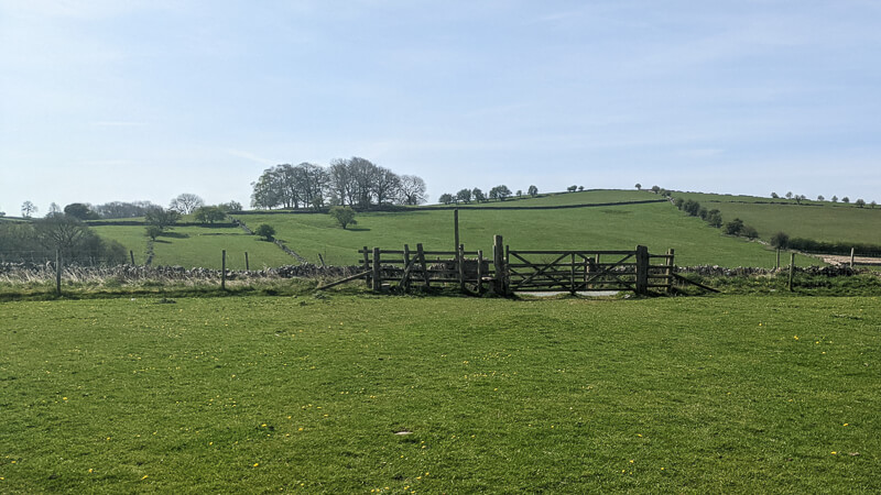
From the car park, walk out the way you drove in and turn right, heading across the grounds of Ilam Park down a steep bank, (Ilam Hall on your right and the church on your left). Walk towards the river and cross the bridge over the River Manifold (photo below).

Once you’ve crossed, turn left, (this is full of wild garlic in springtime). Follow the path until you reach a small gate. Head through the gate and continue to follow the path. Go across the road and continue on the path going uphill, also signposted by a public footpath sign. To your left there are sweeping views of Bunster Hill and Thorpe Cloud.

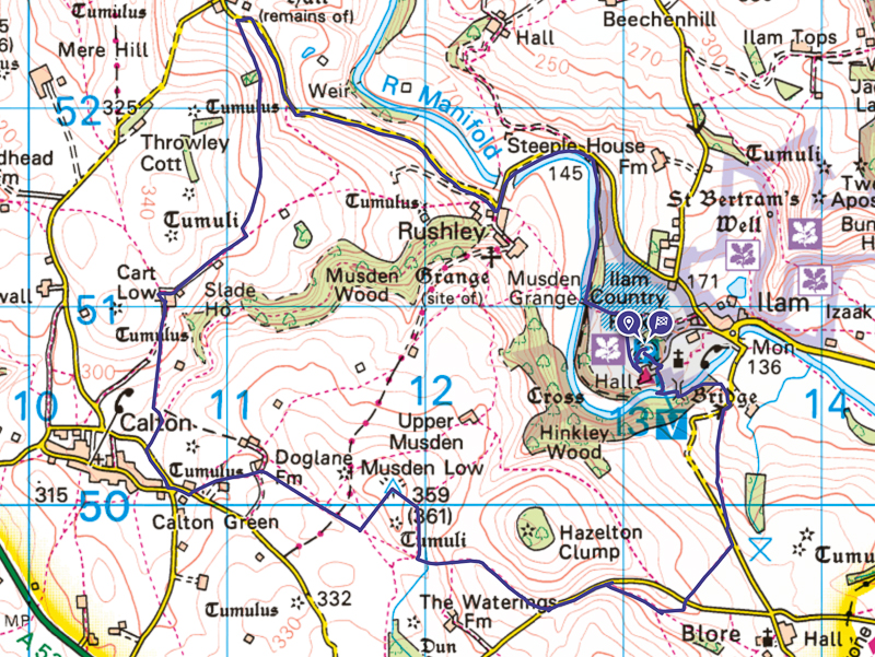
You will reach another gate which takes you into Blore Pastures car park* (photo above). Head through the car park to your right, go across the road and climb over the stile.
*This is a second option for parking on this route.
Stage 2 – Blore Pastures to Musden Low
Distance: 1.5 miles/2.4 km
Grid reference SK 135 498
Head through the field on the path, (and remember to turn around to take in the views!) At the end of the field, you will reach another stile (photo below), go over and across the road and over another stile, before heading downhill to your right.
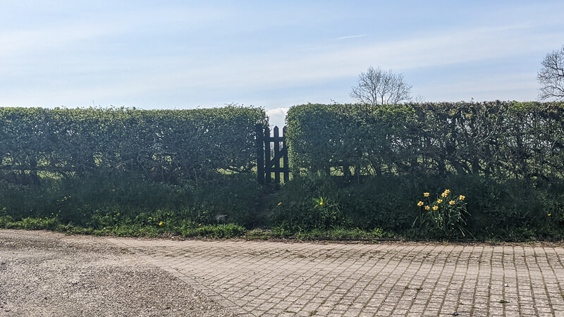
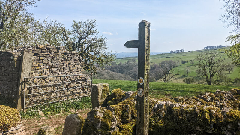
Follow the path until it brings you to a stile and out onto the road again. Turn left, head along the road, until a public footpath sign appears on your right (photo below). Walk along this grassy path, bordered by a drystone wall to your left and a hedge to your right.

You will reach a stepped stone stile, climb over into the next field. Head across the field, and over a stone, stepped stile in the drystone wall. There used to be an open gateway here but it has been shut off now (photo below, taken before gateway was shut off) then begin walking steeply uphill heading left.

You are beginning the climb to the ‘Ethel‘ and trig point Musden Low, at the crest of the hill you need to start heading to your right, towards a gate in a wall. Head through the gate and again start walking uphill to your right and the trig point will begin to come into view. Take a break at the trig point and admire the glorious views of the hills of the White Peak on the Staffordshire and Derbyshire border (photo below).

Stage 3 – Musden Low to Calton
Distance: 0.9 miles/1.4 km
Grid reference SK 118 500
From the trig point, begin heading back the way you came but track downhill to the right, heading towards a drystone wall (photo below). At the drystone wall you will see a metal gate, go through and immediately walk through a wooden gate to your right.

Continue to follow the footpath through the fields and begin to walk towards the left of the field, where a cottage will come into view. Go through the metal gate at the cottage and walk down a farm track for a few metres where you will go through a gate in the hedge (photo below).
Walk across the next field, where you will reach a stone stile in the drystone wall. Head over this, walk towards the left hand side of the field and over another stile in the drystone wall and into a farmyard.

Walk across the farmyard to stile in a hedge, (photo above).* Go over the field to a wooden stile, with several round public footpath markers on it. Ignoring the paths heading to the right, climb over the stile and follow the path to your left which brings you to a wooden gate and out onto a road. Head right down the road (photo below) until you reach a crossroads in the village of Calton.
*Update spring 2025 – (From walker Graham) The ‘stile in the hedge’ is no longer available due to nesting birds in the hedge and a permissive pass (finger post signed) to Green Lane is available to bypass this instead of using the stile in the drystone wall into the farmyard.

Stage 4 – Calton to Throwley Old Hall
Distance: 1.8 miles/2.9 km
Grid reference SK 107 500
At the crossroads, turn right. Walk along the road until you see a wooden gate and public footpath appear on your right hand side and follow this. After about 100m, you will pass through a metal gate and the path will fork. Take the left hand fork, walking uphill through a narrow field and staying close to the drystone wall on your right (photo below).
At the top of the field, you will reach a wooden stile, which you should head over and then through a large wooden gate. Follow the footpath to Slade House, and walk through the farm to a fingerpost with a hand pointing ‘Throwley’ to the right. This path takes you behind the house and through a drystone wall, again marked with a fingerpost (photo below). Head through two large fields, hugging the drystone wall to your right and admiring the surrounding views.
You will reach a fingerpost in the last field and to your left will be a stone structure. Start walking to the left, around the front of the stone structure and slightly downhill towards a stone step stile in the drystone wall, marked with a fingerpost. Hike through a large field, again slightly downhill and towards a clump of trees, which you should keep on your left.

At this point, the dramatic ruins of Throwley Old Hall come into view below, over a small road (photo above). Walk towards them. Spend a while admiring the remains of Throwley Old Hall and sweeping views down the Manifold Valley. If you’ve brought a picnic, this is a great place to have it!
Stage 5 -Throwley Old Hall to Ilam Park
Distance: 2.5 miles/4 km
Grid reference SK 111 524
Once you are ready to begin walking again, now picking up the Manifold Way trail, onto the small road you just crossed over to get to it. Turn left and follow the road along the Manifold Valley, all the way to Rushley. Follow the road as it bends to the left and cross over Rushley Bridge (photo below).

After about 200m, the road will bend to the right. Follow this and a small holiday cottage will appear on your right, with a small wooden gate next to it. Walk through the gate, and then another (photo below), and follow the footpath as it meanders alongside the river on the right.

You re-enter Ilam Park and the path becomes gravel. Before a wooden gate, the gravel path will fork and take the path heading uphill to the left.This opens into a final field and the car park will come in to view.
Ask me any questions about the walk in the comments below.
Buy a printable/downloadable PDF route guide for the walk here.
Other information
Shorter walk option
We have another walk from Blore Pastures car park, if you fancy a shorter route this might be perfect – Blore Pastures, Ilam Hall + Park Walk From Blore Pastures | 4-Mile Route
More walks in the Peak District
Love the walks in the Peak District? You might like these White Peak walks.
- Chee Dale Walk From Miller Dale (Stepping Stones Walk) | 5-Mile Route
- Alstonefield Walk (Via Milldale + Dovedale) | 7-Mile Route
- High Wheeldon Short Trig Walk From Earl Sterndale | 3-Mile Route
Or check out all our Peak District walking routes here
Peak District Walks is a FREE online resource. Are you enjoying the walks? You can say thank you and buy me a coffee here. Thank you very much 🙂
Peak District charity patches
Read about the charity here.


Charity Patches

Charity Patches

Charity Patches

Charity Patches

Charity Patches

Charity Patches
Need more help planning your Peak District trip?
Join our Peak District walks Facebook page, follow us on Instagram and Twitter for inspiration.
More information on the Peak District, including transport options, where to stay, best Peak District pubs + other useful resources.
Check out the 7 YHAs in the Peak District and find the best walks direct from your accommodation.
Find out what maps you will need for your trip here.
Top tips - Read our useful guides on hiking tips here.
Guided Walks with an introduction to map reading (see dates here).
Visit our hiking recommendations page, (footwear, clothes + kit).
Or get in touch and I will help as best I can :).
Please note 'Peak District Walks' accepts no liability for any injuries or accidents resulting from walking our routes. We always recommend you wear appropriate footwear to avoid injuries and to take a paper map and compass on your walks. Read more here.
*Peak District Walks participates in the Amazon Services Associates Programme, as well as other affiliate programmes. If you purchase through these, Peak District Walks earn from the qualifying links. This is at no extra cost to you. Read more here.
Ilam hall, musden low and throwley hall – great walk, quite a few hills, tremendous views especially of Thorpe Cloud and Bunster Hill. We started at Blore, plent of free parking there. Know Ilam well, but never done this walk before. Will certainly be doing it again. Thanks!
Ah wonderful Clare, really glad you enjoyed the walk. Thanks so much for sharing your day 🙂
Blore pasture is now a pay and display car park. £1.50/ hour
Ah thanks Mary, I’ll update that in the walk information 🙂
The ‘stile in the hedge’ at Stage 3 – Musden Low to Calton is no longer available due to nesting birds in the hedge and a permissive pass (finger post signed) to Green Lane is available to bypass this instead of using the stile in the drystone wall into the farmyard.
Ah that’s so lovely to hear that the nesting birds are being looked after, thanks for letting me know, I’ll add a note onto the walk 🙂
Fantastic walk. We went a bit off course and walked through Musden woods, beautiful and not a sole to be seen
Thanks Melissa, I’m pleased to hear that you enjoyed the walk. Here’s to many more enjoyable days in the Peak District 🙂