
A lovely 8-mile route that takes you on a circular walk from Hartington village.
The route takes you via the old site of Pilsbury Castle, here you can see the earthworks of the motte and bailey castle, built partly on a limestone knoll which no doubt offered more protection! You can see an interesting artistic impression of what Pilsbury Castle would have looked like which makes exploring the area more fun!
From Hartington, you head out of the village via a short road section then it’s across fields with Sheen Hill in the distance. On the route you have an option to detour to include one trig point (Sheen Hill) and two Ethels – Carder Low and Pilsbury Hill (see details below).
Continue along the path before heading down to explore Pilsbury Castle, then it’s on to Crowdicote, there’s a small village pub here where you could stop for a halfway break. Alternatively, you could start the walk from Longnor and here’s where you’d join the route. You’ll then head back via a longer road section, walking past Sheen Hill, before descending back into Hartington.
Please note this is a lovely route, but not a great one if you don’t like stiles (or have a dog that doesn’t like them). Read the ‘Other information’ section for details. Or check out our stile-free walks here.
Here you will find details on how to get to the start of the walk at Hartington, route information, map, GPX file, plus a detailed step by step guide of the walk.
Let me know in the comments if you’ve done this Pilsbury Castle walk and what you think!
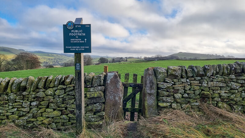
Pilsbury Castle from Hartington

Walk information
Walk type: Medium circular walk
Distance: 8 miles/12.5 km
Walk time: 3-4 hours
Total ascent: 280 m/918 ft
Highest point: 333 m/1,092 ft
Walk highlights: Hartington Village, views of Sheen Hill, Pilsbury Castle
Trigs: 0 (Option to add Sheen Hill)
Ethels: 0 (Option to add Carder Low + Pilsbury Hill)
Stiles: 19 (see details below)
Pilsbury Castle walk map

© Crown copyright and database rights (2024) OS 002572460
Click for online mapWalk start point

Start grid reference: SK 12767 60331
Car parking address: Parson’s Field Car Park, Parsons Close, Hartington, Buxton, SK17 0BE. Google Location.
Parking Cost*
Up to 1 hour £1.70
1 – 2 hours £2.70
2 – 3 hours £4.00
3 – 4 hours £5.20
All day £6.20
Evening parking cost is £1.20 (from 6 pm to 8 am).
There are also a few free parking spaces in the village square but these fill up pretty quickly!
*Correct at time of writing
Public transport
The nearest train station is Buxton train station (11 mile/18 km). You can catch the High Peak buses run a service from Buxton to Hartington, number 442 bus, it’s about 40 minutes on the bus.
Facilities on the walk

There are public toilets available at the start of the walk at Hartington, opposite the car park next to the farm shop. There are also a couple of pubs, cafe (Beresford Tea Room) and shops in the village to visit after your walk. I recommend the Devonshire Arms, a lovely pub with open fires in winter months.
Other useful information
There are a couple of road walking sections on this walk, about 1 km at the beginning and 1.5 km towards the end, you can’t really avoid these unless you extend the walk considerably.
On the flip side there are also a couple of very muddy section, one short section at the start and the length of a field at the end. Waterproof hiking boots recommended and a sense of ‘getting muddy is ok’ attitude!

There were cows in a couple of fields on this walk, they paid no attention to me on my walk; however this may be different if you walk with a dog or during calving time.
Stiles on this walk – yes, you read right there are 19 in total, although it didn’t feel too bad when I was doing the walk. For the dog-owners this would not be a suitable walk if they can’t get over stiles. There are 12 stone stile, 7 wooden ones and only one was dog-friendly. You can find our stile-free walks here.
Please keep the Peak District beautiful and respect everyone who uses the park. Take ALL your rubbish home to dispose of and remember close gates (as you found them). Thank you so much.
Would you know what to do in an emergency situation?

We have a guide with what to do, who you need to call and also some useful kit that should be in your backpack. Ask us any questions in the comments or via our social media.
Happy hiking + stay safe
read herePeak District weather
Check the weather for your walk location and hills. It’s often good to check a few resources.
- BBC Weather for Hartington
- Met Office weather for Hartington Hall Hostel
- Met Office weather and/or MWIS (Mountain weather information service) for the Peak District
Ordnance Survey walk map
The map required for this walk is the Ordnance Survey OL24 – Peak District (White Peak Area). Check prices here with Ordnance Survey or Amazon. If you’re hiking in all weathers the Active OS maps are pretty good to have.
View both Peak District map options here.
And don’t forget your compass, I recommend the Silva Expedition or the Silva Classic compass.
For online maps, I recommend OS Online App (I have been using for 4+ years and worth getting if you want to start walking more). Check prices here for the one month or yearly option with OS Online App. All the walks on the website are created using OS Online + you can download them to the App.
See both maps that cover the Peak District here.
Pilsbury Castle walk route
Stage 1 – Hartington to Cardor Low
Distance: 1.5 miles/2.4 km
Grid reference SK 12767 60331
From Hartington Village car park, turn left and walk back towards the village. Cross the road and turn right walking past the Devonshire Arms pub and Beresford Tea Rooms. You’ll reach a crossroads with corner shop, cross the road and turn left heading up the side road next to the church.

Then walk up the road for about 1 km, as the road bends around to the right, near a large farm barn, on your left there is a fingerpost signposted to Pilsbury and Crowdicote. Go over the stone stile (photo below), this is a short very muddy section. Be careful you don’t grab the electric fence to steady you! Walk towards the stone wall, over another stone stile then in the subsequent field, a wooden stile next to a tree.

Continue across the next wider field to a stone stile, then though a small wooden gate with views of Sheen Hill beyond. Follow the path next to the wall and through a wide gate opening with a small arrow sign. The footpath is feint, continue heading north at the same level, walk past a couple of arrow signpost markers until you reach a gap in the fence with stones to climb over. The next stone wall has a newer wooden gate to go through and the next one is a wooden dog-friendly stile (photo below).

Option to add Ethel – Cardor Low – on your right is Cardor Low, this is located on Access Land, therefore you are able to walk up to the hilltop without permission. I didn’t hike up but there was a feint trod on the right, look out for this to add a short out and back (approx 1 km).
Stage 2 – Cardor Low to Pilsbury Castle
Distance: 1.4 mile/2.2 km
Grid reference SK 1271 6236
Keep walking along the path, the next wall has a small wooden gate, then after that there’s another gate with a signpost for Pilsbury and Crowdicote. Follow the signpost to another small gate next to a metal gate, you’ll reach the corner of the wall where you now head slightly uphill and across a grassy section, at the next corner you’ll see another signpost, head right towards stone steps and gate over a wall.
Walk down the grassy slope to the path junction and turn left here, go past a tall stone then continue towards the buildings and over a wooden stile across the narrow road then gate opposite, signposted towards Crowdicote. Keep walking go through a wooden gate, then skirt around where the wall has collapsed.

Keep next to the wall on your right (photo above), following the numerous arrow markers, over a wooden stile then begin your descent down the grassy path to Pilsbury Castle earthworks and through the gate at the bottom.

Option to add Ethel – Pilsbury Hill – this time on your right is Pilsbury Hill, again it’s located on Access Land, however, check the map to see which areas. It’s a steeper hike up for this one, or you may be able to get up from the other side. I’ll try to return and figure it out! (Out and back approx 1.5 km).
Stage 3 – Pilsbury Castle to Under Whitle
Distance: 2.3 miles/3.7 km
Grid reference SK 1148 6387
Once you’ve explored the earthworks for Pilsbury Castle, head back down to the path and through the wooden gate and follow the grassy path, through another wooden gate, on your right you’ll see the River Dove. Go through a gap next to some gates, then through a wide metal gate next to a stone stile and walk through the farm (photo below), immediately after turn left down the track.

Option to detour straight on here and visit Crowdicote pub (The Pack Horse Inn). Walk down the track and return the same way to continue the walk.

Go across the wooden bridge and take the path heading left signposted Under Whitle. Go over a small wooden bridge and continue heading with the river now on your left. There’s another wooden bridge, with a stile both before and after. Head uphill towards the metal gate, beyond this you’ll find a stone stile in the wall.
Follow the arrows around the perimeter then between the two buildings, turn right and head uphill to a wooden stile. Turn right and walk up the wide track, then over another stone stile with yellow arrow (photo below), go alongside the fence then bear right and it’ll bring you out at a new wooden gate.

There’s a wide track, use the footpath on the right, to the top, here is where you take the grassy path on the left towards the gate in the wall (not the wide track), signposted Hartington via Sheen Road. Head towards the road, over a stone stile next to a signpost (photo below).
Stage 4 – Under Whitle to Hartington
Distance: 1.9 miles/3.1 km
Grid reference SK 1075 6351
At the road, turn left and follow it all the way down for about 1.5 km, you’ll walk past Sheen Hill, which has a trig point.
Sheen Hill option to detour – another out and back but Sheen Hill is on private land so you’ll need to seek permission from the landowner.

Keep walking down the road all the way until the road bends round to the right, on this corner you’ll see a public footpath signpost, turn left, then immediate right through the farm, there’s a signpost for Hartington (photo above) that takes you over a stone stile and beyond the building, then it’s through a gap to the second very muddy section of the walk!
Walk next to the wall, through a serious of fields going over a gap in the first stone wall, then a stone stile, a small wooden gate and another stone stile. The route heads through a small wooded section and a stone stile. From here you head on the path downhill, this was also muddy and slippy in places (I fell on my bum oops!)
At the bottom go through a gate, turn right down the track, then look for a small gate on your left (photo below), go straight across the field over a small bridge and turn right, across the fields and three small gates. Go through the gate in the wall (near a house new-build), through another gate, across the field and though a gate that leads to the road.

Turn left and the road will bring you back out in Hartington Village, where you can turn right back to the car park or pop in one of the pubs or cafe.
Ask me questions about this walk in the comments below.
More walk options
Extend the walk
There are a few options detailed within the walk to add on the Ethels and a trig point. If you do all these that will add another 2.1 miles/3.4 km to the walk
More walks in the Peak District
Love the walks in the Peak District? You might like these Hartington circular walks.
- Wolfscote Hill Short Trig Walk From Hartington | 4-Mile Route
- Wolfscote Dale + Biggin Dale Walk From Hartington | 5-Mile Route
Or check out all our Peak District walking routes here
Peak District Walks is a FREE online resource. Are you enjoying the walks? You can say thank you and buy me a coffee here. Thank you very much 🙂
Peak District charity patches
Read about the charity here.


Charity Patches

Charity Patches

Charity Patches

Charity Patches

Charity Patches

Charity Patches
Need more help planning your Peak District trip?
Join our Peak District walks Facebook page, follow us on Instagram and Twitter for inspiration.
More information on the Peak District, including transport options, where to stay, best Peak District pubs + other useful resources.
Check out the 7 YHAs in the Peak District and find the best walks direct from your accommodation.
Find out what maps you will need for your trip here.
Top tips - Read our useful guides on hiking tips here.
Guided Walks with an introduction to map reading (see dates here).
Visit our hiking recommendations page, (footwear, clothes + kit).
Or get in touch and I will help as best I can :).
Please note 'Peak District Walks' accepts no liability for any injuries or accidents resulting from walking our routes. We always recommend you wear appropriate footwear to avoid injuries and to take a paper map and compass on your walks. Read more here.
*Peak District Walks participates in the Amazon Services Associates Programme, as well as other affiliate programmes. If you purchase through these, Peak District Walks earn from the qualifying links. This is at no extra cost to you. Read more here.
Really nice walk with great views,the 442 bus also goes from Ashbourne if that’s more convenient and is slightly quicker although there’s no service on Sunday return buses are at 15.08;16.18 and 18.12 ,although the first rule of hiking by public transport is that you get to your destination five minutes after a bus has left,no hardship in Hartington to be fair though.
Ah brilliant, top tips there Rob, thanks so much for adding those, I’m sure people travelling from there will find that useful. Happy hiking 🙂