
Did you know that Edale is one of the most popular places to start a walk from in the UK? If you’re planning a trip to the Peak District it is certainly a great place to start your adventures from with some wonderful walks from Edale.
Nestled in the Hope Valley, Edale has some great Peak District hills surrounding it, including the popular Mam Tor but it’s also a great place to hike up Kinder Scout, the highest point in the Peak District.
Here are 9 of my favourite routes starting from this beautiful Derbyshire village, including detailed guides with the full route, map and GPX file. As well as including all the other useful (and boring) information, like getting there and parking costs! But hopefully, you’ll find everything you need for a perfect trip to the Peak District.
Have you done any of these Edale walks? Let me know in the comments.
Edale Walk Information
Here you can find how to get to Edale, parking and public transport options, the OS map that you’ll need for all the walks (it’s the same map) and also useful tips on the facilities, shops and pubs in Edale as well as a few great places to stay if you’re planning a weekend trip.
How to get to Edale?
Public transport
Travelling to Edale you have options for either public transport via the train, the station is right next to the main car park and the place where all the walks start from. The trains run roughly about once an hour so it’s a good service for starting your adventures.
The Hope Valley Line run by Northern Railway connects the Peak District between Sheffield and Manchester, making it easy to get to by public transport – good news if you don’t have a car! The train route also stops at a few other great places in the Peak District, including Hope, Bamford, Hathersage and Grindleford.
Driving
Or you can drive, Edale is accessible from all the main cities close by – Sheffield, Manchester and Nottingham, roughly taking about 45-75 minutes to get there.
You can drive into Edale village from two directions, one goes turn right down Edale Road from Hope village and takes an easier route. The second option is a prettier more scenic route as it takes the road through Winnats Pass and in between Mam Tor and Lord’s Seat, although, this isn’t a good route to take in winter!
Where to park in Edale?
There’s a main car park in the village, which is a decent size, although during peak times it can get very busy. To guarantee a space it’s best to arrive early as the road are very narrow in Edale and there’s no street parking, the car’s you see are all residents spots.
During busy periods over the summer and weekends, there is a second overflow car park, a short distance away and is signposted when it’s open.
In addition, Edale train station, which is opposite the car park also has a few spaces.
Edale car park address: Edale village hall car park, Edale, Hope Valley, S33 7ZQ
Grid reference: SK 12381 85327
Parking cost (cash only)*
- 1 hour – £1.60
- 2 hours – £2.50
- 4 hours – £5.00
- 10 hours – £6.00
- 24 hours – £7.00
*Prices correct at time of writing.
You can also use the PaybyPhone option either call or use the App to pay for parking, there are numerous other Peak District car parks that use this so its worth downloading the App. (The one with 9 green squares logo).
What map do you need for the Edale walk?

These walks are in a remote part of the Peak District and when the weather is bad it can be challenging to navigate, especially on Kinder Scout so it’s worth getting a map and knowing how to use it.
For all these walks, you need one map – OL1 – Peak District (Dark Peak Area)
You can buy a paper map at outdoor shops or shop online at Amazon or Ordnance Survey
And don’t forget your compass, I recommend the Silva Expedition compass, it’s more expensive but a valuable piece of kit!
For online maps, you can get via OS Online App or Viewranger App.
Check prices here for the one month or yearly option with OS Online App.
What other facilities are there in Edale?

Public toilets
Firstly, there are public toilets at the Village Hall car park, the most important thing to know before you go on a long hike!
Visitor Centre
Next to the campsite, there is a small visitor centre which useful information about the area, plus a small gift shop if you need to buy any last-minute presents.
Edale pubs
There are two pubs in Edale – The Ramblers Inn and Old Nags Head. There is one at each end of the village, they are lovely pubs that serve food and both have outdoor beer gardens.
The Ramblers Inn has a larger outdoor area but the Old Nags Head is the traditional start of the Pennine Way (and end if you walk in the other direction). I recommend visiting both on different day = more hikes = more pubs!
Cafe + shop
Next to the train station is the Penny Pot cafe, perfect for snacks and cake after your walk. There is also a village shop which is the opposite end of the village, near the Nags Head.
Where to stay in Edale?

Camping
There’s a lovely campsite in the centre of Edale – Fieldhead Campsite, Edale, S33 7ZA. This has various different levels so at a glance it looks small when you walk past but there are a few options for places to camp.
Or there’s a second campsite at Newfold Farm, Grindsbrook Booth, Edale, S33 7ZD
YHA Edale
The accommodation at YHA Edale is about 1.5 miles out of the village, but if you’re travelling on a budget or want to go self-catering then it’s a perfect option to base yourself.
Other accommodation
There are various different places to stay in Edale from guesthouses, cottages and also single rooms. You can search via Airbnb accommodations in Edale – if you’ve not used before then you can get £34 off your first trip (use within a year of signing up)
Or alternatively, you can search via Booking.com which has around 13 different options (some are the same as Airbnb).
Want to read later? Save the walk to Pinterest

9 Best walks from Edale
Here is a mix of different walks from Edale, they are organised by distance, the shortest walk first (4 miles) up to the longest hike (24 miles), but there are plenty in between too so hopefully, you’ll find the perfect walk (or walks) for you.
There are some of the classic routes, including Mam Tor and Kinder Scout via Jacob’s Ladder, plus a few other options that are equally as beautiful but maybe you won’t have heard of them before.
Each route has a full walk guide, simply pick a walk you like the sound of, click the button and that will give you all the useful information you need about the walk, including a map, route instructions, GPX file and a few other useful tips for your adventure.
Ringing Roger via Ollerbrook
Distance: 3.9 miles/6.2 km
Walk time: 2-3 hours
Total ascent: 346 m/1,135 ft
A lovely short walk from Edale but with epic views so if you are looking for a shorter route that still packs a punch then this one is for you. From Edale you ascend via one of the quieter routes up to the Kinder Plateau so it’s perfect for a weekend walk if you want to get away from the popular paths.
It’s a steep hike up but those views at the top of Ringing Roger are wonderful and there are plenty of places to stop on a rock to enjoy the views before looping back downhill to Edale.
Here’s the full route, including more details about the walk and GPX file.
Walk route, map + GPX file hereGrindslow Knoll (via Grindsbrook Clough or Ringing Roger)
Distance: 4 miles/6.4 km or 5.5 miles/9 km
Walk time: 2-3 hours or 2.5-3.5 hours
Total ascent: 591 m/1,939 ft or 535 m/1,755 ft

Here’s a great short walk you can do up Grindsbrook Knoll from Edale, which can often get missed on Kinder Scout walks since it involves an out and back option. And yes, I know the summit doesn’t look that exciting but I promise it has great views at the top.
I’ve included two options, a shorter 4-mile route which includes a steeper/rockier ascent and a short scramble via Grindsbrook Clough or alternatively, there’s a 5.5-mile option which takes you up a more gradual route via Ringing Roger.
(Links to both routes are below so you can pick the walk that suits you).
From Edale, you start on the same route, but the Ringing Roger option takes you off the path soon after you reach the flagstoned path and loops around the edge, whereas the Grindsbrook Clough walk takes you straight up via a pretty direct route.
Grindslow Knoll has a rather large cairn marking the summit but it gives you a nice 360-degree view of the hills around you. Then it’s a gradual descent back down the other side and meeting up with the Pennine Way before back to Edale.
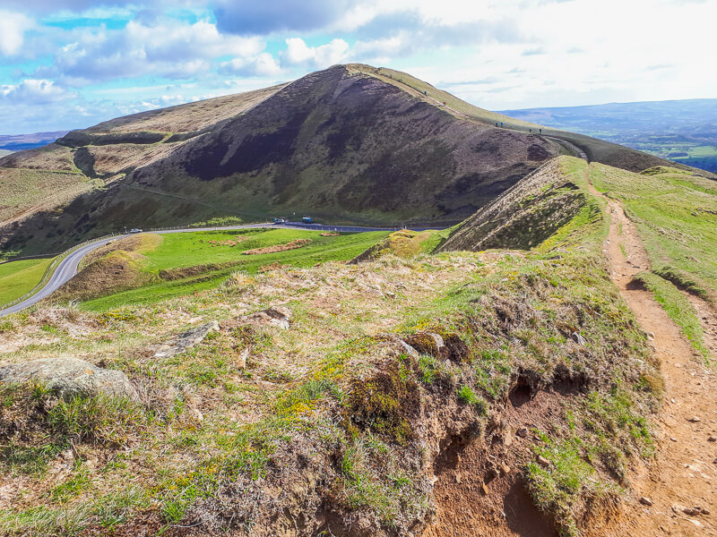
Mam Tor via Back Tor
Distance: 5 miles/8 km
Walk time: 2.5-3 hours
Total ascent: 416 m/1,365 ft

This short walk takes you up Harden Clough, a narrow but quieter route up to the ridge the out on to the road just below Mam Tor. There’s a very short section on the road but then you’re on the main path up to Mam Tor.
The first part of this walk is all uphill, but it’s a gradual incline so not too bad. Then from Mam Tor, you have a lovely downhill section to Hollins Cross. The walk then continues along the Great Ridge to Back Tor.
This route includes hiking up Back Tor, which is optional because it’s an up and then down option, but Back Tor has some beautiful views back along the ridge so it’s worth that climb to the top.
Once you’ve descended you then take the path back down, which meets the road then it’s about 600 metres back into Edale.
Here’s the route map, full walk guide coming soon.
Walk route + map hereKinder Scout via Grindsbrook Clough
Distance: 8 miles/13 km
Walk time: 4-5 hours
Total ascent: 806 m/2,644 ft

Starting with one of my favourite circular walks from Edale (and my very first hike up Kinder Scout). From Edale, you head past the Nags Head then over the bridge beyond the village.
The walk takes you along flagstones before reaching another small wooden bridge and along a track which gradually ascends for the first part. The path then turns rockier and you have to cross over Grindsbrook Clough several times to find the best route up.
Then the final section is a pretty steep climb to the top, which also involves a small amount of scrambling as you make your way up to the cairn at the top.
From here you navigate across the Kinder Plateau, past Crowden Rocks then loop around near Noe Stool (another rock) before descending down Jacob’s Lader and back via Upper Booth into Edale via the Pennine Way.
You can do this walk in reverse but the hike up Grindsbrook Clough is easier to do climbing up, instead of down!
Here’s the full route, including more details about the walk and GPX file.
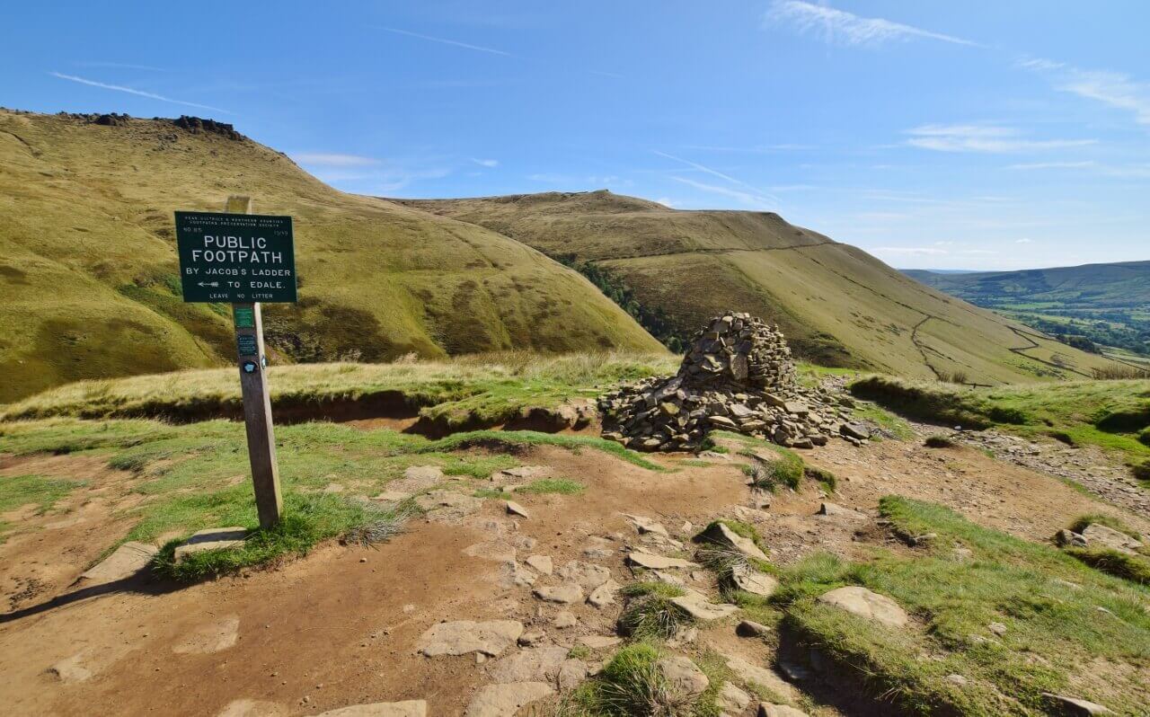
Walk route, map + GPX file hereKinder Scout via Jacob’s Ladder
Distance: 8-10 miles/13-17 km
Walk time: 4-5 hours
Total ascent: 670-782 m/2,198-2,565 ft

Here’s a great route from Edale and maybe one of the most popular. There are two locations that people associate with walks from Edale, one is Kinder Scout and the other is Jacob’s Ladder.
From Edale, it’s a lovely route following the start of the Pennine Way path to a packhorse bridge (pictured above), this also marks the start of Jacob’s Ladder, a short but steep climb up and beyond to Kinder Scout.
This route takes you up past Edale Rocks and on to Kinder Low, the trig point on the eastern side of the plateau. However, because this is a popular route I have given you five different options for walking back to Edale via Crowden Clough, Grindslow Knoll, Grindsbrook Clough and Ringing Roger.
They are all slightly different, some include scrambling, whereas others are a more gentle descent into the valley.
For the full guide, including each map and GPX file read more here.
Walk routes, maps + GPX hereMam Tor via Jacob’s Ladder + Rushup Edge
Distance: 10 miles/16 km
Walk time: 4-5 hours
Total ascent: 624 m/2,047 ft

Mam Tor is the most popular places to visit in the Peak District, so why not combine with a lovely circular loop via Jacob’s Ladder and Rushup Edge before reaching the trig point at the summit.
This walk begins from Edale and then takes you via the Pennine Way national trail which starts from the Old Nags Head at the opposite end of the village from the car park.
The route begins on a lovely flat terrain, that is until you reach Jacob’s Ladder, then there’s a steep ascent up large steps that winds up to the top. The section can be quite busy as it’s a popular path, but once you reach the top of the track, you’ll turn off to head for Brown Knoll.
This is probably the least glamorous part of the hike, making your way across the flagstones to reach the trig point but then on to Rushup Edge and the Lord’s Seat which more than makes up for it.
From Rushup Edge, you have beautiful views towards Mam Tor, then it’s a small downhill and a final uphill to Mam Tor summit before heading down the great ridge to Hollins Cross and from here you turn off the ridge and descend into Edale.
For the detailed route, map and more information read the full post here.
Walk route + map here
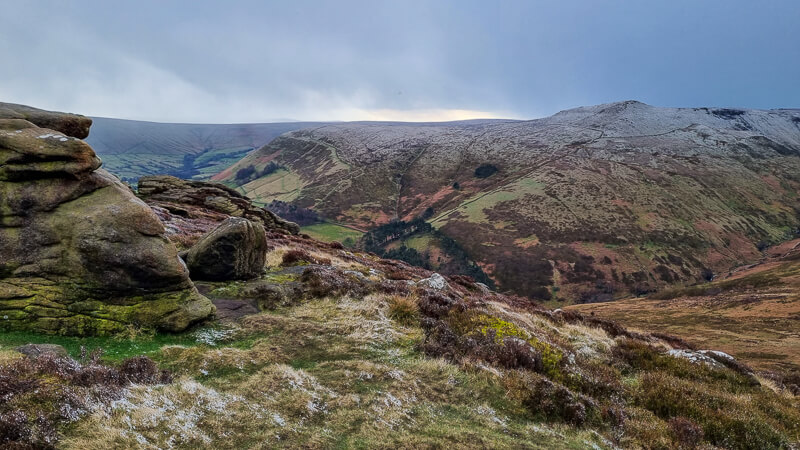
Kinder Scout via Kinder Downfall + Kinder Reservoir
Distance: 15 miles/24 km
Walk time: 7-8 hours
Total ascent: 1,183 m/3,881 ft

Here’s a fantastic long walk for your list, that includes some great highlights on the way.
The hike begins with a scramble up Grindsbrook Clough, then it’s on to Kinder Scout and Kinder Downfall, (depending on the weather will either mean a trickle of water or an impressive backwards waterfall!)
There are lovely views along this section, looking down to Kinder Reservoir and it’s also a beautiful place to watch the sunset begin to set, it does eventually disappear behind the hills but it’s a great spot to watch the sky change colour.
Continue along the Pennine Way, then it’s down William Clough to Kinder Reservoir, then along and back around to meet up with the Pennine Way near the Swine’s Back before heading down Jacob’s Ladder and back to Edale for a well-deserved pint of beer (or lime cordial).
Read the full walk guide here, including map and GPX file
Full walk route herePennine Way Trail (Edale to Crowden)
Distance: 17 miles/28 km
Walk time: 8-9 hours
Total ascent: 1,008 m/3,307 ft

Edale is the start of the long-distance national trail, the Pennine Way, although it’s not the longest in the UK, it’s known as the toughest due to the remoteness of the trail, including miles of moorlands and hills through the Pennines.
Here’s a great way to do to sample this long-distance hike with a linear hike. The Edale to Crowden section is traditionally known as day 1 on the trail, you can hike further but the next stop with amenities would be another 9 miles along the trail, so an even longer hike!
This long walk takes in many highlights, from starting in Edale itself to hiking up Jacob’s Ladder on to Kinder Downfall and across to Snake Pass (via the boring bit – sorry every walk has one!)
From Snake Pass, you then head up to Bleaklow and eventually bringing you out alongside Torside Clough then on to Clough Edge where you have great views down to Torside Reservoir and the end of your walk at Crowden.
It’s down Clough Edge, across the road and reservoir and then woods on the other side and not too long after you reach the car park and campsite at Crowden (the campsite is currently closed for 2020 and reopening in 2021).
Read the full walk and more information here.
Walk route + map here
Edale Skyline walk
Distance: 24 miles/36 km
Walk time: 10-12 hours
Total ascent: 1,252 m/4,107 ft
Adding this gigantic walk in here that you can do from Edale. The Edale Skyline is a huge circular walk around the hilltops of the Hope Valley and since it’s a circular walk you can join at any point along the route.
The route below starts in Hope, but there’s also an option to start the walk from Edale, you’ll find the route details, map and both GPX files in the post below.
If you love your long hikes then this is a great one to see lots of the Peak District classics in one walk, from the most popular hill Mam Tor to Kinder Scout, although this Edale Skyline route doesn’t go to the exact summit at 636 metres.
But you’ll also get to walk along the Great Ridge as well as another iconic hill – Win Hill where you have stunning views of Ladybower Reservoir and the Upper Derwent Valley (another great place for your next trip!)
Click here for all the route information about the Edale Skyline walk.
Walk route, map + GPX hereAre there any other walks from Edale you were thinking of doing? Let me know in the comments
More walks in the Peak District
For more routes nearby to Edale, you might like these walks from Castleton and Barber Booth
- Rushup Edge + Mam Tor Walk From Barber Booth | 6-Mile Route
- Mam Tor Short Walk From Castleton | 5-Mile Route
- Winnats Pass Walk From Castleton (+ Mam Tor) | 5-Mile Route
Or check out all our Peak District walking routes here
Save me to your Hiking boards on Pinterest

*Peak District Walks participates in the Amazon Services Associates Programme, as well as other affiliate programmes. If you purchase through these, Peak District Walks earn from the qualifying links. This is at no extra cost to you. Read more here.
Peak District Walks is a FREE online resource. Are you enjoying the walks? You can say thank you and buy me a coffee here. Thank you very much 🙂
Peak District charity patches
Read about the charity here.


Charity Patches

Charity Patches

Charity Patches

Charity Patches

Charity Patches

Charity Patches
Need more help planning your Peak District trip?
Join our Peak District walks Facebook page, follow us on Instagram and Twitter for inspiration.
More information on the Peak District, including transport options, where to stay, best Peak District pubs + other useful resources.
Check out the 7 YHAs in the Peak District and find the best walks direct from your accommodation.
Find out what maps you will need for your trip here.
Top tips - Read our useful guides on hiking tips here.
Guided Walks with an introduction to map reading (see dates here).
Visit our hiking recommendations page, (footwear, clothes + kit).
Or get in touch and I will help as best I can :).
Please note 'Peak District Walks' accepts no liability for any injuries or accidents resulting from walking our routes. We always recommend you wear appropriate footwear to avoid injuries and to take a paper map and compass on your walks. Read more here.
Pingback: Ringing Roger Short Walk From Edale | 4-Mile Route - Peak District Walks
Pingback: Blackden Brook to Kinder Plateau (Scramble + Waterfall Route) - Peak District Walks